ShopDreamUp AI ArtDreamUp
Deviation Actions


Suggested Deviants


Suggested Collections


You Might Like…


Featured in Groups

Description
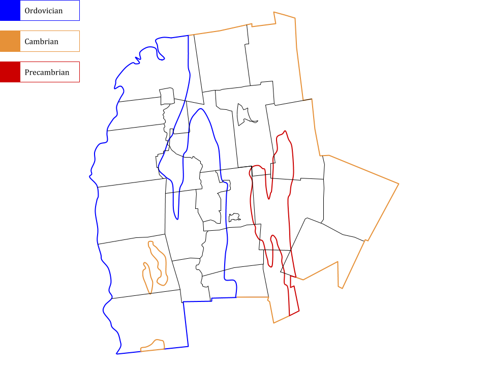
Thank you to everyone who wished me a happy birthday. Above is a geologic map I made of Addison County, Vermont based on another map, illustrated by Charles G. Doll (of the Vermont Geological Survey), that resides in my school's science hall. Here, the different colors represent the ages of the county's *underlying rock, with black outlines showing the current borders of local communities - including towns, the city of Vergennes, and census-designated places.
*There are notable areas where fossiliferous rock is exposed in the county, such as in the town of Panton, where I have collected fossils from the Crown Point Formation: en.wikipedia.org/wiki/Crown_Po…
Any critiques are welcome as I am new to making maps (I hope to make a few different versions of the one above).
Image size
960x720px 61.76 KB
© 2018 - 2024 Ceratopsia
Comments2
Join the community to add your comment. Already a deviant? Log In
I think a scale bar and some labels for townships would be helpful.